Unofficial information site of Vileyka

 |
Unofficial information site of Vileyka
|
|
|
vileykainfo.by |
||||
|
|
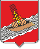
Vileyka is the district center of the Minsk region of the Republic of Belarus. The city is located on the right bank of the Viliya River, 100 km northwest of Minsk. It is believed that Vileyka appeared about five centuries ago. However, archaeological finds indicate that people established a permanent settlement near today's borders of Vileyka much earlier. The first people on the territory of the modern Vileika region appeared around the 9th millennium BC. Not far from the villages of Sosenka and Ostashkovo, sites of ancient people and flint tools were found, according to which the age of the found sites is attributed to 7-5 millennium BC. Later archaeological sites dating back to the Neolithic era (4-2 millennium BC) were found near the villages of Kameno, Kastyki, Kurenets, Naroch, Rabun and some others. There are a lot of archaeological finds on the territory of the Vileika region dating back to the Bronze and Iron Ages, including those near Vileika itself. Approximately from the middle of the 1st millennium AD, the time of the Bantser culture began. Since the time of the Krivichi-Dregovichi Slavs, numerous funerary monuments have been preserved. There are more than 20 burial mounds of the 9th-12th centuries AD on the territory of the Vileika region. In the X-XIII centuries the territory of modern Vileika region was part of the Principality of Polotsk, and from the 14th to the 17th centuries was part of the Grand Duchy of Lithuania. During this period, the settlement was called Old Kurenets. According to the latest research, the first written mention of Vileyka dates back to 1460. But a few years ago, the date of the first mention was considered to be 1599. Due to this, Vileika celebrated its 400th anniversary and 550th anniversary with a difference of only 11 years. Since 1793, after the 2nd partition of the Commonwealth, Vileyka has been part of the Russian Empire. The settlement was located for more than a kilometer along the banks of the Viliya and has the only street. In 1795 Vileika became a county town. Since 1796 Vileyka had the own Coat of arms. The modern Coat of arms of Vileyka contain only the lower part from its original image. In the old days the main occupations of the inhabitants were agriculture and river navigation. Timber and agricultural products were exported to Europe along the Viliya and further along the Neman. Large trade fairs were held annually in the city till the end of the 19th century. The largest glass manufactory on the territory of modern Belarus was grounded in Ilya in the 18th century. In the 19th century there was a cloth factory not far from Dolginovo. By the end of the 19th century there were more than 3.5 thousand inhabitants in Vileyka, 59% of them were not literate. In total, more than 200 thousand inhabitants lived in the Vilna province. Since the beginning of the XIX century, after a great fire in 1810 and war destruction in 1812, a major reconstruction of the city began. Since 1845, Vileyka has become the center of the Vilna province. Its renewal continued, and the old buildings were completely replaced within a century. Many buildings of modern Vileyka were founded in the late 19th - early 20th centuries. Water cargo transportation along the river in the 20th century was replaced by significant flows of goods and passengers through the Vileika railway station, opened in 1904. Since November 8, 1917 Soviet power was established in Vileyka. It lasted a little over a year. In December 1918 Vileyka was occupied by German troops, in 1919 was occupied by Polish troops, since 1921 Vileyka became part of Poland and remained a provincial town on its outskirts until 1939. After the transition of Western Belarus to the USSR, Vileyka received the status of the center of the Vileyka region, that existed almost until the end of the Second World War. In September 1944, two months after the area was liberated from the Nazi invaders, Vileyka became the regional center of the Molodechno region (since 1960 - Minsk region). During the Second World War, the area was under occupation (from 06/25/1941 to 07/2/1944). During the years of the war, the Nazi invaders destroyed more than 15 thousand civilians in the region and completely burned 5 villages along with the population. Two villages (Lubcha and Borki) were never rebuilt after the war. Nowadays, the Vileyka district occupies an area of ??2400 square kilometers. Most of the territory of the district is a hilly area with many lakes and partially drained swamps. Almost half of the region's area (more than 41%) is occupied by coniferous and mixed forests. On the territory of the district there is the largest artificial reservoir in the republic - the Vileyka reservoir, created in 1974. Its area is almost 65 sq. km, and the average volume of water is 0.24 billion cubic meters. The Vileyka reservoir is the part of the Vileyka-Minsk water system, which includes a cascade of reservoirs connected by artificial channels with five water pumping stations. The Vileyka-Minsk water system constructed to provide the capital of Belarus with high-quality drinking water in the required quantity. Additional data on Vileyka and Vileyka district are given on the page Statistics. Reprinting of materials is allowed only with a link to the Vileyka-Info website. | |||
|
|
© I.Ryndevich (igrnd.by) |